.png)
Diploma in Geographic Information System (G.I.S.) and Global Positioning System Admission
Check Diploma in Geographic Information System (G.I.S.) and Global Positioning System eligibility, admission process, entrance exam options, college guidance, skill outcomes and career possibilities.
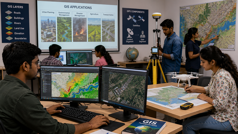%20and%20Global%20Positioning%20System.png)
Program ID
DIPET0182
Course Name
Diploma in Geographic Information System (G.I.S.) and Global Positioning System
Program
Diploma
Program Full Name
Diploma in Engineering and Technology
Academic Stream
Engineering and Technology
Program Level
Diploma
Program Type
Diploma
Course Category
Technical Education
Mode of Study
Regular
Course Delivery Mode
Offline / Campus Based
Eligibility Level
After 10th
Admission Session
2026-27
About Program
Diploma in Geographic Information System (G.I.S.) and Global Positioning System is designed for students who want an early technical qualification in Geographic Information System (G.I.S.) and Global Positioning System with practical exposure to digital systems, programming, networks and practical computing applications. Students study core concepts, drawing or documentation practices, lab/workshop tasks, safety habits and problem-solving methods used in software support, IT services, digital platforms and technology operations. The learning approach is practical and career-oriented, helping students understand how Geographic Information System (G.I.S.) and Global Positioning System is used in real projects, service environments and production settings. Students can use this diploma as a career-starting qualification as well as a base for further technical education in a related field.

Eligibility Criteria
• Passed Class 10 / Secondary School Examination or equivalent from a recognized board.
• Minimum marks and subject requirements should be checked as per the concerned state board, counselling authority or institute rules.
• Students with relevant vocational or ITI background may be considered for suitable admission routes where permitted.
• Reserved category relaxation, if applicable, will be available as per state or institute norms.
.png)
Entrance Exams
• State Polytechnic Entrance Exam
• State-level diploma counselling
• Institute-level merit admission
• Direct admission based on Class 10 marks where permitted
• Lateral entry / vocational route where applicable
.png)
Admission Process
• Check eligibility, course availability and institute admission notification.
• Register for the state polytechnic entrance exam or counselling process, wherever applicable.
• Fill the application form carefully and upload required documents.
• Appear for entrance test, merit list or institute-level selection as applicable.
• Participate in counselling, choose preferred institutes and confirm seat allotment.
• Complete document verification and fee payment to secure admission.
.png)
Required Documents
• Class 10 marksheet and passing certificate
• Transfer certificate / school leaving certificate
• Character certificate, if required by the institute
• Domicile certificate, if required for state quota
• Category / reservation certificate, if applicable
• Entrance exam admit card and scorecard, if applicable
• Recent passport-size photographs
• Valid photo ID proof
.png)
Colleges for this Course
• Pusa Institute of Technology, New Delhi
• Ambedkar Institute of Technology, Delhi
• Government Polytechnic, Mumbai
• Government Polytechnic, Pune
• Government Polytechnic, Nagpur
• Government Polytechnic, Ahmedabad
• Government Polytechnic, Lucknow
• Government Polytechnic, Bengaluru
• Government Polytechnic, Hyderabad
• Government Polytechnic, Chennai
.png)
Career Scope
Career scope in Diploma in Geographic Information System (G.I.S.) and Global Positioning System is focused on construction, surveying, materials, infrastructure development and site execution, helping students build practical skills for entry-level jobs, higher studies and long-term industry growth.
• Students can begin with roles such as site supervisor trainee, civil CAD technician, survey assistant, quality control lab technician.
• Opportunities are available in construction companies, real estate firms, highway projects, consultancies, government contractors.
• Career growth improves with site practice, drawing reading, estimation skills and material testing experience.
• With experience, students can grow towards site supervisor, quantity surveyor assistant, CAD designer, quality control executive or project planning support roles.
• Higher study and upskilling options include B.Tech. lateral entry, AutoCAD, STAAD, quantity surveying, project management or construction safety certifications.
.png)
Skills You Learn
• Students learn core concepts of Geographic Information System (G.I.S.) and Global Positioning System, basic engineering principles, drawings, materials, systems and applied technical terminology for Geographic Information System (G.I.S.) and Global Positioning System.
• They practise using relevant lab tools, workshop equipment, measurement instruments, software basics and industry documentation formats related to Geographic Information System (G.I.S.) and Global Positioning System applications and technical operations.
• Lab and workshop learning includes practical exercises, lab work, field tasks, mini projects and troubleshooting activities connected with Geographic Information System (G.I.S.) and Global Positioning System.
• The course develops safety, quality control, measurement accuracy, maintenance awareness and professional documentation practices required in Geographic Information System (G.I.S.) and Global Positioning System applications and technical operations.
• Students build technical communication, teamwork, project planning, reporting and job-ready problem solving for entry-level technical roles with focus on Geographic Information System (G.I.S.) and Global Positioning System career readiness.
.png)
Suitable For
• Diploma in Geographic Information System (G.I.S.) and Global Positioning System is suitable for students interested in Geographic Information System (G.I.S.) and Global Positioning System applications, technical operations and practical industry-oriented learning.
• This course fits learners of Geographic Information System (G.I.S.) and Global Positioning System who want practical, skill-based training linked with real industry work.
• It is useful for candidates aiming for entry-level technician, assistant engineer, supervisor trainee, service support or production support roles.
• It is a good choice for students who want to build Geographic Information System (G.I.S.) and Global Positioning System related technical confidence before jobs or higher studies.
• It also supports learners planning lateral entry to B.Tech./B.E. or specialised upskilling connected with Geographic Information System (G.I.S.) and Global Positioning System.
.png)
Higher Education Options
• B.Tech./B.E. lateral entry options in Civil Engineering, Environmental Engineering, Construction Technology, Transportation Engineering, Geomatics or Surveying-related branches.
• Advanced diploma or specialization in geographic information system (g.i.s.) and global positioning system, structural drafting, construction management, surveying, gis, water systems or environmental services.
• B.Tech./B.E. lateral entry, B.Planning/B.Voc. Construction or related undergraduate pathways where applicable.
• Autocad, revit, staad, gis, total station, quantity surveying, estimation, site safety and construction project management certifications.
• Site training, field survey, drawing practice and project work connected with geographic information system (g.i.s.) and global positioning system to strengthen higher study and employability options.
.png)
Related Courses
• Diploma in Water Technology and Health Science
• Diploma in Geo informatics
• Diploma in Environmental Engineering
• Diploma in Climate Technology
• Diploma in Survey Engineering
.png)
FAQs
Q1. What is Diploma in Geographic Information System (G.I.S.) and Global Positioning System?
A1. Diploma in Geographic Information System (G.I.S.) and Global Positioning System is a diploma-level technical program focused on computer applications, software systems and digital technology. It helps students understand the practical foundations of Geographic Information System (G.I.S.) and Global Positioning System and prepares them for industry-oriented technical work.
Q2. What do students learn in Diploma in Geographic Information System (G.I.S.) and Global Positioning System?
A2. Students learn programming, databases, computer networks, web technologies, operating systems, digital tools, troubleshooting and project-based software practice. The learning is usually supported by workshops, lab work, drawings, tools, software practice, maintenance tasks or small technical projects related to Geographic Information System (G.I.S.) and Global Positioning System.
Q3. What is the career scope after Diploma in Geographic Information System (G.I.S.) and Global Positioning System?
A3. Career scope after Diploma in Geographic Information System (G.I.S.) and Global Positioning System is available in IT companies, software service firms, startups, banks, ed-tech companies, digital agencies and technical support teams. Students can start with roles such as software trainee, web support executive, IT technician, data entry analyst, network support assistant and junior developer roles, depending on institute training, location and employer requirements.
Q4. Who should choose Diploma in Geographic Information System (G.I.S.) and Global Positioning System?
A4. This course is suitable for students interested in coding, computers, software, apps, websites, databases and technology-based problem solving. It is a good option for students who want job-ready technical skills after Class 10 or an equivalent qualification.
Q5. What are the higher study options after Diploma in Geographic Information System (G.I.S.) and Global Positioning System?
A5. Students can choose lateral entry to B.Tech. or B.E. in a relevant engineering branch, apply for advanced diploma-level training, or complete skill certifications in tools, software, safety, maintenance or domain-specific technologies.